
Cutler Creek topographic map
Interactive map
Click on the map to display elevation.
About this map
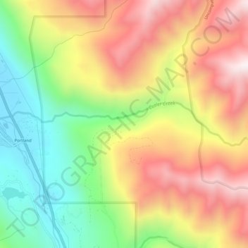
Name: Cutler Creek topographic map, elevation, terrain.
Location: Cutler Creek, Ouray County, Colorado, United States (38.08054 -107.70641 38.08740 -107.65598)
Average elevation: 2,654 m
Minimum elevation: 2,198 m
Maximum elevation: 3,127 m