Geolocate

Kibid topographic map

Click on the map to display elevation.

About this map

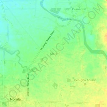
Name: Kibid topographic map, elevation, terrain.

Location: Kibid, Norala, South Cotabato, Soccsksargen, 9508, Philippines (6.51838 124.65487 6.55838 124.69487)

Average elevation: 98 m

Minimum elevation: 85 m

Maximum elevation: 110 m

Gear up for your next adventure:

📸Action Cameras - Record your journey across interesting topographic features in 4K
🪢Paracord - Multi-purpose survival cord
🕶️Polarized Outdoor Sunglasses - Reduce glare from rocks and water for better visual navigation
👖Convertible Hiking Trousers - Zip-off legs to adapt to changing temperatures throughout the day
🔋Solar Power Banks - Charge your phone and GPS using the sun while deep in the bush

As an Amazon Associate, this site earns from qualifying purchases at no extra cost to you.