
阳高县 topographic map
Interactive map
Click on the map to display elevation.
About this map
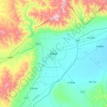
Name: 阳高县 topographic map, elevation, terrain.
Location: 阳高县, 大同市, 山西省, 中国 (40.20363 113.58341 40.52363 113.90341)
Average elevation: 1,325 m
Minimum elevation: 1,004 m
Maximum elevation: 2,254 m
Other topographic maps
Click on a map to view its topography, its elevation and its terrain.