
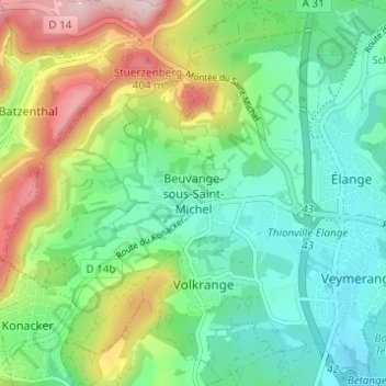
Beuvange-sous-Saint-Michel topographic map
Interactive map
Click on the map to display elevation.
About this map
Name: Beuvange-sous-Saint-Michel topographic map, elevation, terrain.
Average elevation: 251 m
Minimum elevation: 167 m
Maximum elevation: 425 m
Other topographic maps
Click on a map to view its topography, its elevation and its terrain.
Œutrange
France > Grand Est > Moselle > Thionville
Œutrange, Thionville, Moselle, Grand Est, France métropolitaine, 57100, France
Average elevation: 266 m
Pont du Couronné
France > Grand Est > Moselle > Thionville
Pont du Couronné, Rue du Couronné, Cormontaigne, Thionville, Moselle, Grand Est, France métropolitaine, 57100, France
Average elevation: 159 m
Garche
France > Grand Est > Moselle > Thionville
Garche, Thionville, Moselle, Grand Est, France métropolitaine, 57100, France
Average elevation: 168 m