Geolocate

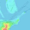
Carrington topographic map

Click on the map to display elevation.

About this map

Name: Carrington topographic map, elevation, terrain.

Location: Carrington, Newcastle, Newcastle-Maitland, New South Wales, 2294, Australia (-32.92363 151.75907 -32.90260 151.77697)

Average elevation: 3 m

Minimum elevation: -3 m

Maximum elevation: 25 m

New South Wales trails, hiking, mountain biking, running and outdoor activities

Other topographic maps

Click on a map to view its topography, its elevation and its terrain.
Jesmond Park

Australia > New South Wales > Newcastle

Average elevation: 35 m

Cameron Park

Australia > New South Wales > Newcastle

Average elevation: 23 m

Glenrock Lagoon

Australia > New South Wales > Newcastle

Average elevation: 39 m

Nobbys Beach

Australia > New South Wales > Newcastle

Average elevation: 3 m

Redhead Bluff

Australia > New South Wales > Newcastle

Average elevation: 13 m

Dixon Park

Australia > New South Wales > Newcastle

Average elevation: 12 m

Gear up for your next adventure:

🔥Windproof Plasma Lighters - USB rechargeable lighters that work in high-altitude winds
🪫Rechargeable Headlamps - USB rechargeable headlamps
🔥Camping Stoves - Portable stoves for outdoor cooking
🧢Wide Brim Sun Hats - Maximum coverage for the face and neck while out in the open
🪢550 Survival Paracord - Versatile cordage for gear repair and emergency lashing

As an Amazon Associate, this site earns from qualifying purchases at no extra cost to you.