Geolocate

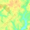
Kilmarnock topographic map

Click on the map to display elevation.

About this map

Name: Kilmarnock topographic map, elevation, terrain.

Location: Kilmarnock, Lancaster County, Virginia, United States (37.68767 -76.40043 37.73260 -76.36425)

Average elevation: 16 m

Minimum elevation: -1 m

Maximum elevation: 32 m

Other topographic maps

Click on a map to view its topography, its elevation and its terrain.

Ottoman

United States > Virginia > Lancaster County

Average elevation: 10 m

Ottoman

United States > Virginia > Lancaster County

Average elevation: 10 m

Ottoman

United States > Virginia > Lancaster County

Average elevation: 10 m

Alfonso

United States > Virginia > Lancaster County

Average elevation: 27 m

Gear up for your next adventure:

🎒Tactical Waist Packs - Quick access to your compass, phone, and snacks while walking
🔪Outdoor Multi-tools - Versatile tools for gear repair and survival tasks in the wilderness
📕Hiking Guide Books - Guides for hiking trails
🥾Hiking Boots - Durable hiking boots for trails and rough terrain
🦘Outback Survival Gear - Essential gear for Australian outback

As an Amazon Associate, this site earns from qualifying purchases at no extra cost to you.