

Make a donation
Gear up for your next adventure:
As an Amazon Associate, this site earns from qualifying purchases at no extra cost to you.
River Pines topographic map
Click on the map to display elevation.
Make a donation
Gear up for your next adventure:
As an Amazon Associate, this site earns from qualifying purchases at no extra cost to you.
About this map
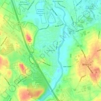
Name: River Pines topographic map, elevation, terrain.
Average elevation: 54 m
Minimum elevation: 30 m
Maximum elevation: 89 m
Make a donation
Gear up for your next adventure:
As an Amazon Associate, this site earns from qualifying purchases at no extra cost to you.
Other topographic maps
Click on a map to view its topography, its elevation and its terrain.
Concord River
United States > Massachusetts > Middlesex County > Billerica
The river begins in Middlesex County, formed by the confluence of the Sudbury and Assabet Rivers at Egg Rock, near the Concord town center. It flows generally north, from eastern Concord (along the northwestern edge of the Boston metropolitan area), joining the Merrimack River from the south on the eastern…
Average elevation: 50 m