
Sira Phat topographic map
Interactive map
Click on the map to display elevation.
About this map
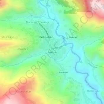
Name: Sira Phat topographic map, elevation, terrain.
Location: Sira Phat, Besisahar, Besishahar, लमजुङ, Gandaki, 33600, Népal (28.20557 84.35875 28.24557 84.39875)
Average elevation: 951 m
Minimum elevation: 635 m
Maximum elevation: 1,585 m