
La Reid topographic map
Interactive map
Click on the map to display elevation.
About this map
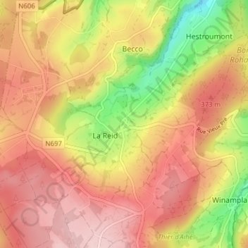
Name: La Reid topographic map, elevation, terrain.
Location: La Reid, Theux, Verviers, Luik, Wallonië, 4910, België (50.46946 5.77057 50.50946 5.81057)
Average elevation: 332 m
Minimum elevation: 208 m
Maximum elevation: 413 m