
Tébessa topographic map
Interactive map
Click on the map to display elevation.
About this map
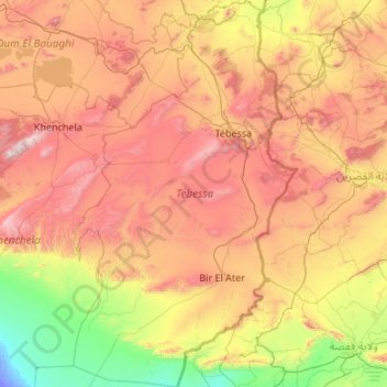
Name: Tébessa topographic map, elevation, terrain.
Location: Tébessa, Algérie (34.24376 7.22751 36.00378 8.47653)
Average elevation: 757 m
Minimum elevation: -21 m
Maximum elevation: 2,130 m
Other topographic maps
Click on a map to view its topography, its elevation and its terrain.