Geolocate

Meransen - Maranza topographic map

Click on the map to display elevation.

Meransen - Maranza

Meransen (Italian: Maranza) is a village in South Tyrol, Italy, in the Mühlbach municipality between Pustertal and Eisacktal. It located on the slopes of the Gitschberg mountain at an altitude of 1,414 m (4,639 ft).

About this map
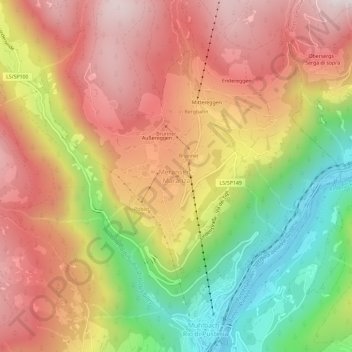
Name: Meransen - Maranza topographic map, elevation, terrain.

Location: Meransen - Maranza, Mühlbach - Rio di Pusteria, Eisacktal - Valle Isarco, South Tyrol, Trentino – Alto Adige/Südtirol, 39037, Italy (46.79335 11.64200 46.83335 11.68200)

Average elevation: 1,279 m

Minimum elevation: 714 m

Maximum elevation: 1,743 m

Gear up for your next adventure:

📚Map Reading & Navigation Guides - Master the art of interpreting topographic contours and symbols
🧥Softshell Jackets - Flexible outdoor jackets
⌚GPS Watches - GPS watches for outdoor sports
🌿Flora and Fauna Field Guides - Identify the plants and animals you encounter on your route
🧣Merino Neck Gaiters - Versatile headwear for warmth, sun protection, or dust filtering

As an Amazon Associate, this site earns from qualifying purchases at no extra cost to you.