
Byfleet topographic map
Click on the map to display elevation.
About this map
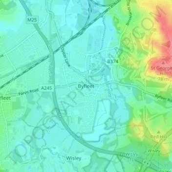
Name: Byfleet topographic map, elevation, terrain.
Location: Byfleet, Woking, Surrey, England, KT14 7PN, United Kingdom (51.32017 -0.49290 51.36017 -0.45290)
Average elevation: 27 m
Minimum elevation: 11 m
Maximum elevation: 82 m
Other topographic maps
Click on a map to view its topography, its elevation and its terrain.
Horsell Common
United Kingdom > England > Surrey > Woking > Horsell > Durnford Farm
Average elevation: 29 m