
Thank you for supporting this site ❤️
Make a donation
Make a donation
Gear up for your next adventure:
As an Amazon Associate, this site earns from qualifying purchases at no extra cost to you.
Roblin topographic map
Click on the map to display elevation.
Thank you for supporting this site ❤️
Make a donation
Make a donation
Gear up for your next adventure:
As an Amazon Associate, this site earns from qualifying purchases at no extra cost to you.
About this map
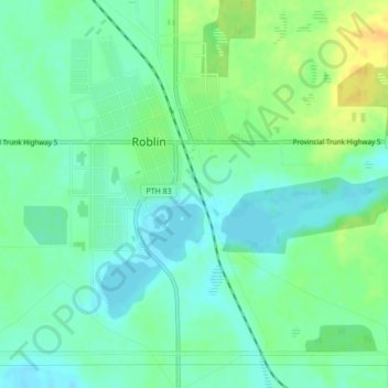
Name: Roblin topographic map, elevation, terrain.
Location: Roblin, Municipality of Roblin, Manitoba, R0L 1P0, Canada (51.21359 -101.37531 51.23554 -101.33460)
Average elevation: 552 m
Minimum elevation: 542 m
Maximum elevation: 567 m
Thank you for supporting this site ❤️
Make a donation
Make a donation
Gear up for your next adventure:
As an Amazon Associate, this site earns from qualifying purchases at no extra cost to you.