Geolocate

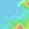
Tagburos topographic map

Click on the map to display elevation.

About this map

Name: Tagburos topographic map, elevation, terrain.

Location: Tagburos, Puerto Princesa, Mimaropa, Philippines (9.79985 118.72097 9.83985 118.76097)

Average elevation: 16 m

Minimum elevation: -2 m

Maximum elevation: 127 m

Other topographic maps

Click on a map to view its topography, its elevation and its terrain.

Baywalk Park

Philippines > Puerto Princesa

Average elevation: 6 m

Bacungan River

Philippines > Puerto Princesa

Average elevation: 123 m

Irawan River

Philippines > Puerto Princesa

Average elevation: 120 m

Tagkawayan Beach

Philippines > Puerto Princesa

Average elevation: 48 m

Sabang River

Philippines > Puerto Princesa

Average elevation: 39 m

Manors Verdant

Philippines > Puerto Princesa

Average elevation: 5 m

Gear up for your next adventure:

🦯Adjustable Trekking Poles - Reduce impact on knees when descending steep topographic ridges
🐍Australian Snake Bite Kits - Specific pressure immobilization bandages for Australian venomous snakes
🧭Global Orienteering Compass - High-precision liquid-filled compasses for accurate map reading and navigation
🔪Multitools - Compact tools for outdoor use
📡Portable Emergency Radios - Stay informed about weather warnings and bushfire alerts

As an Amazon Associate, this site earns from qualifying purchases at no extra cost to you.