Geolocate

Luquin topographic map

Click on the map to display elevation.

About this map

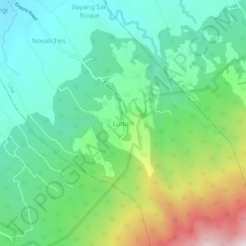
Name: Luquin topographic map, elevation, terrain.

Location: Luquin, Liliw, Laguna, Calabarzon, 4004, Philippines (14.08005 121.44357 14.12005 121.48357)

Average elevation: 664 m

Minimum elevation: 320 m

Maximum elevation: 1,473 m

Gear up for your next adventure:

🔪Outdoor Multi-tools - Versatile tools for gear repair and survival tasks in the wilderness
🔌Fast Charging Adapters - Quickly top up all your gear before heading back into the field
🏫Topographic World Globes - 3D physical relief globes to understand global geography
🥾Hiking Gaiters - Leg protection for trails
🧥Thermal Emergency Blankets - Compact Mylar blankets to prevent hypothermia if stranded overnight

As an Amazon Associate, this site earns from qualifying purchases at no extra cost to you.