Geolocate

Anaheim topographic map

Click on the map to display elevation.

About this map
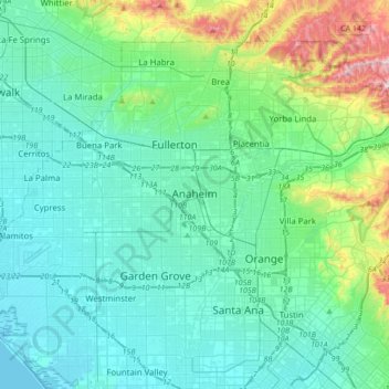
Name: Anaheim topographic map, elevation, terrain.

Location: Anaheim, Orange County, California, United States (33.78892 -118.01736 33.87906 -117.67397)

Average elevation: 89 m

Minimum elevation: -3 m

Maximum elevation: 513 m

Gear up for your next adventure:

📣High-Decibel Survival Whistles - Signaling tool for rescue that carries much further than a human voice
📡Satellite Messengers - Emergency communication devices
🍳Ultralight Camping Stoves - Boil water quickly for meals using minimal fuel
⛺Lightweight Tents - Compact tents for backpacking
🧴SPF 50+ Bulk Sunscreen - Maximum protection for long-term outdoor exposure

As an Amazon Associate, this site earns from qualifying purchases at no extra cost to you.