
Make a donation
Gear up for your next adventure:
As an Amazon Associate, this site earns from qualifying purchases at no extra cost to you.
Vatican City topographic map
Click on the map to display elevation.
Make a donation
Gear up for your next adventure:
As an Amazon Associate, this site earns from qualifying purchases at no extra cost to you.
Vatican City
Vatican City's climate is the same as Rome's: a temperate, Mediterranean climate Csa with mild, rainy winters from October to mid-May and hot, dry summers from May to September. Some minor local features, principally mists and dews, are caused by the anomalous bulk of St Peter's Basilica, the elevation, the fountains, and the size of the large paved square. The highest temperature ever recorded was 40.7 °C (105.3 °F), on both 2 August 2017 and 27 June 2022.
Make a donation
Gear up for your next adventure:
As an Amazon Associate, this site earns from qualifying purchases at no extra cost to you.
About this map
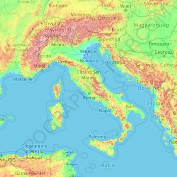
Name: Vatican City topographic map, elevation, terrain.
Location: Vatican City (34.90341 5.45285 48.90341 19.45285)
Average elevation: 324 m
Minimum elevation: -4 m
Maximum elevation: 4,188 m
Make a donation
Gear up for your next adventure:
As an Amazon Associate, this site earns from qualifying purchases at no extra cost to you.