Geolocate

Auckland Domain topographic map

Click on the map to display elevation.

Auckland Domain

During the 2023 Auckland Anniversary Weekend floods, a lake reformed in the lower elevation area of Pukekawa / Auckland Domain that was once a wetland.

Wikipedia (CC-BY-SA 3.0)

About this map

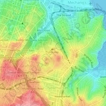
Name: Auckland Domain topographic map, elevation, terrain.

Location: Auckland Domain, Parnell, Auckland, Waitematā, Auckland, New Zealand (-36.86457 174.77053 -36.85357 174.78082)

Average elevation: 49 m

Minimum elevation: 0 m

Maximum elevation: 107 m

Gear up for your next adventure:

🧥Softshell Jackets - Flexible outdoor jackets
🧦Hiking Socks - Comfortable socks for long hikes
🧢Wide Brim Sun Hats - Maximum coverage for the face and neck while out in the open
🍴Titanium Spork & Cutlery - Indestructible and feather-light eating utensils
👣Snake & Scrub Gaiters - Protection against spinifex, mud, and snakes while walking off-track

As an Amazon Associate, this site earns from qualifying purchases at no extra cost to you.