
Epse topographic map
Interactive map
Click on the map to display elevation.
About this map
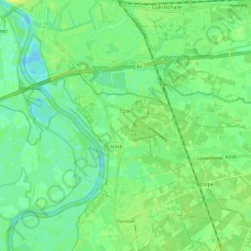
Name: Epse topographic map, elevation, terrain.
Location: Epse, Lochem, Geldern, Niederlande (52.21004 6.16627 52.23383 6.26158)
Average elevation: 8 m
Minimum elevation: 0 m
Maximum elevation: 12 m
Other topographic maps
Click on a map to view its topography, its elevation and its terrain.