
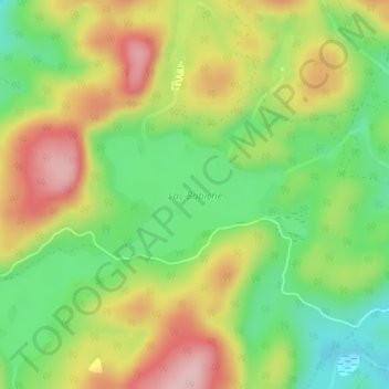
Lac Babiche topographic map
Interactive map
Click on the map to display elevation.
About this map
Name: Lac Babiche topographic map, elevation, terrain.
Average elevation: 346 m
Minimum elevation: 254 m
Maximum elevation: 455 m
Other topographic maps
Click on a map to view its topography, its elevation and its terrain.
Île de Six Milles
Canada > Québec > Antoine-Labelle > Notre-Dame-de-Pontmain
Île de Six Milles, Notre-Dame-de-Pontmain, Antoine-Labelle, Laurentides, Québec, Canada
Average elevation: 248 m
Lac du Camp
Canada > Québec > Antoine-Labelle > Notre-Dame-de-Pontmain
Lac du Camp, Notre-Dame-de-Pontmain, Antoine-Labelle, Laurentides, Québec, Canada
Average elevation: 213 m
Lac des Trente et un Milles
Canada > Québec > Antoine-Labelle > Notre-Dame-de-Pontmain
Lac des Trente et un Milles, Notre-Dame-de-Pontmain, Antoine-Labelle, Laurentides, Québec, Canada
Average elevation: 173 m