Geolocate

Debenham topographic map

Click on the map to display elevation.

About this map

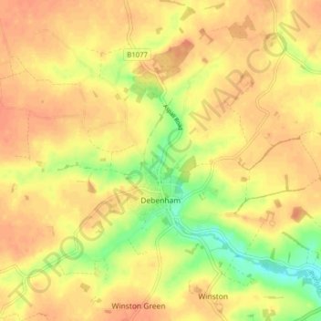
Name: Debenham topographic map, elevation, terrain.

Location: Debenham, Mid Suffolk, Suffolk, England, United Kingdom (52.20602 1.14163 52.25255 1.22027)

Average elevation: 53 m

Minimum elevation: 26 m

Maximum elevation: 65 m

Gear up for your next adventure:

🔑Heavy Duty Carabiners - Secure gear to the outside of your pack for easy access
🥤Hydration Packs - Hydration systems for hiking
🚁Camera Drones with GPS - Capture aerial views of the landscape to compare with topo maps
🎽Base Layers - Thermal base layers
🛠️Outdoor Repair Kits - Gear repair kits

As an Amazon Associate, this site earns from qualifying purchases at no extra cost to you.