
Ex-hacienda de Ocotza topographic map
Interactive map
Click on the map to display elevation.
About this map
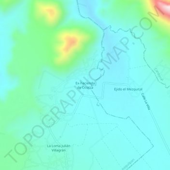
Name: Ex-hacienda de Ocotza topographic map, elevation, terrain.
Location: Ex-hacienda de Ocotza, Ixmiquilpan, Hidalgo, México (20.40167 -99.11639 20.44167 -99.07639)
Average elevation: 1,938 m
Minimum elevation: 1,861 m
Maximum elevation: 2,317 m