Marshfield topographic map
Click on the map to display elevation.
About this map

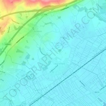
Name: Marshfield topographic map, elevation, terrain.
Location: Marshfield, Newport, Wales, United Kingdom (51.52233 -3.09558 51.55066 -3.03959)
Average elevation: 18 m
Minimum elevation: 0 m
Maximum elevation: 102 m
Other topographic maps
Click on a map to view its topography, its elevation and its terrain.

Caerleon
United Kingdom > Wales > Newport
Caerleon, Newport, Wales, NP18 1AF, United Kingdom
Average elevation: 37 m

Victoria
United Kingdom > Wales > Newport
Victoria, Newport, Wales, NP, United Kingdom
Average elevation: 20 m

Beechwood
United Kingdom > Wales > Newport
Beechwood, Newport, Wales, NP, United Kingdom
Average elevation: 28 m