
San Fedele topographic map
Interactive map
Click on the map to display elevation.
About this map
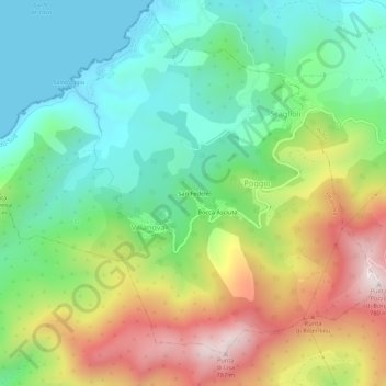
Name: San Fedele topographic map, elevation, terrain.
Average elevation: 283 m
Minimum elevation: -1 m
Maximum elevation: 768 m
Other topographic maps
Click on a map to view its topography, its elevation and its terrain.
Bocca Asciuta
France > Corse > Corse-du-Sud > Poggio
Bocca Asciuta, Poggio, Villanova, Ajaccio, Corse-du-Sud, Corse, France métropolitaine, 20167, France
Average elevation: 318 m