Geolocate

Benschop topographic map

Click on the map to display elevation.

About this map

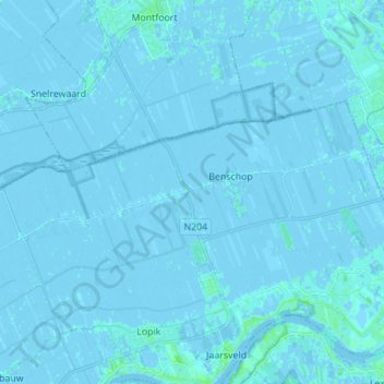
Name: Benschop topographic map, elevation, terrain.

Location: Benschop, Lopik, Utrecht, Netherlands (51.98525 4.89596 52.02563 5.03412)

Average elevation: 0 m

Minimum elevation: -4 m

Maximum elevation: 7 m

Other topographic maps

Click on a map to view its topography, its elevation and its terrain.

Palestina

Netherlands > Utrecht > Amersfoort

Average elevation: 2 m

Amerongse Berg

Netherlands > Utrecht > Amerongen

Average elevation: 34 m

Cabauw

Netherlands > Utrecht

Average elevation: -1 m

Breedeveen

Netherlands > Utrecht > Leersum

Average elevation: 15 m

Eembrugge

Netherlands > Utrecht > Baarn

Average elevation: 1 m

Graaf

Netherlands > Utrecht > Lopik

Average elevation: 0 m

Gear up for your next adventure:

🩹Wilderness First Aid Kits - Comprehensive medical kits tailored for hiking and remote exploration
🔦Powerful LED Headlamps - Hands-free lighting for night navigation and setting up camp after dark
🌧️Rain Jackets - Waterproof jackets for hiking
🧥Down Jackets - Insulated jackets for cold weather
🚗Car Camping Gear - Equipment for vehicle camping

As an Amazon Associate, this site earns from qualifying purchases at no extra cost to you.