Geolocate

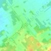
Dundee topographic map

Click on the map to display elevation.

About this map

Name: Dundee topographic map, elevation, terrain.

Location: Dundee, Le Haut-Saint-Laurent, Montérégie, Quebec, J0S 1L0, Canada (44.99280 -74.66020 45.07808 -74.35180)

Average elevation: 60 m

Minimum elevation: 43 m

Maximum elevation: 155 m

Other topographic maps

Click on a map to view its topography, its elevation and its terrain.

Snye

Canada > Quebec > Le Haut-Saint-Laurent > Snye

Average elevation: 49 m

Cazaville

Canada > Quebec > Le Haut-Saint-Laurent

Average elevation: 58 m

Covey Hill

Canada > Quebec > Le Haut-Saint-Laurent > Havelock

Average elevation: 283 m

Doréa

Canada > Quebec > Le Haut-Saint-Laurent > Franklin

Average elevation: 242 m

Gear up for your next adventure:

📸Action Cameras - Record your journey across interesting topographic features in 4K
🧼Biodegradable Outdoor Soap - Clean gear and yourself without harming the local ecosystem
📡Weather Radios - Emergency weather radios
🛠️Outdoor Repair Kits - Gear repair kits
🎒Tactical Waist Packs - Quick access to your compass, phone, and snacks while walking

As an Amazon Associate, this site earns from qualifying purchases at no extra cost to you.