
Minto topographic map
Click on the map to display elevation.
About this map
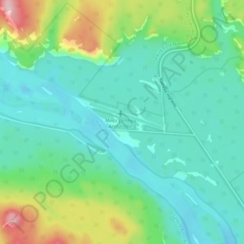
Name: Minto topographic map, elevation, terrain.
Location: Minto, Yukon, Y1A 1P0, Canada (62.57242 -136.89245 62.61242 -136.85245)
Average elevation: 497 m
Minimum elevation: 443 m
Maximum elevation: 663 m