
Kish topographic map
Interactive map
Click on the map to display elevation.
About this map
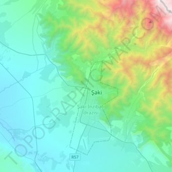
Name: Kish topographic map, elevation, terrain.
Location: Kish, Shaki, 5503, Azerbaïdjan (41.15279 47.01167 41.26832 47.30360)
Average elevation: 848 m
Minimum elevation: 226 m
Maximum elevation: 3,582 m
Other topographic maps
Click on a map to view its topography, its elevation and its terrain.