
Las Cruces topographic map
Interactive map
Click on the map to display elevation.
About this map
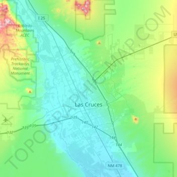
Name: Las Cruces topographic map, elevation, terrain.
Location: Las Cruces, Doña Ana County, Nuevo México, Estados Unidos (32.24169 -106.97396 32.43398 -106.66507)
Average elevation: 1,298 m
Minimum elevation: 1,174 m
Maximum elevation: 1,780 m