
柳河 topographic map
Interactive map
Click on the map to display elevation.
About this map
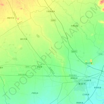
Name: 柳河 topographic map, elevation, terrain.
Location: 柳河, 新民, 新民市, 沈阳市, 辽宁省, 中国 (41.93320 122.55789 42.26827 122.78910)
Average elevation: 49 m
Minimum elevation: 27 m
Maximum elevation: 108 m