Geolocate

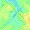
Beira Mar topographic map

Click on the map to display elevation.

About this map

Name: Beira Mar topographic map, elevation, terrain.

Location: Beira Mar, Curuçá, Região Geográfica Imediata de Castanhal, Região Geográfica Intermediária de Castanhal, Pará, Região Norte, Brasil (-0.76126 -47.95149 -0.72126 -47.91149)

Average elevation: 10 m

Minimum elevation: -2 m

Maximum elevation: 22 m

Other topographic maps

Click on a map to view its topography, its elevation and its terrain.
Rio Grande

Brasil > Pará > Curuçá

Average elevation: 15 m

Gear up for your next adventure:

🏃Compression Recovery Socks - Reduce leg fatigue after heavy days of elevation gain
🥾Hiking Shoes - Lightweight hiking shoes for day hikes
🔦Powerful LED Headlamps - Hands-free lighting for night navigation and setting up camp after dark
🌬️Windbreaker Jackets - Wind protection jackets
🏕️Camping Gear - Essential camping equipment

As an Amazon Associate, this site earns from qualifying purchases at no extra cost to you.