
Make a donation
Gear up for your next adventure:
As an Amazon Associate, this site earns from qualifying purchases at no extra cost to you.
Tundra topographic map
Click on the map to display elevation.
Make a donation
Gear up for your next adventure:
As an Amazon Associate, this site earns from qualifying purchases at no extra cost to you.
About this map
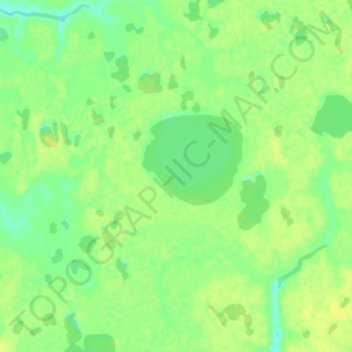
Name: Tundra topographic map, elevation, terrain.
Location: Tundra, Unorganized Borough, Alaska, United States (61.11333 -162.83667 61.15333 -162.79667)
Average elevation: 13 m
Minimum elevation: 3 m
Maximum elevation: 19 m
Make a donation
Gear up for your next adventure:
As an Amazon Associate, this site earns from qualifying purchases at no extra cost to you.
Other topographic maps
Click on a map to view its topography, its elevation and its terrain.
Fairway Rock
United States > Alaska > Unorganized Borough
Fairway Rock lies inside Alaska's Nome Census Area and Alaska Department of Fish and Game Wildlife Conservation Unit 22E. It is conveyed to Inalik Native Corporation. Fairway Rock appears on United States Geological Survey topographic maps in the Teller Quadrangle.
Average elevation: 7 m
Central
United States > Alaska > Unorganized Borough
Central is located at 65°32′0″N 144°41′44″W / 65.53333°N 144.69556°W / 65.53333; -144.69556 (65.533461, -144.695650). The elevation is 942 feet. The Steese Highway (Alaska Route 6) does pass through Central.
Average elevation: 482 m
Make a donation
Gear up for your next adventure:
As an Amazon Associate, this site earns from qualifying purchases at no extra cost to you.
Saint Paul Island
United States > Alaska > Unorganized Borough > St. Paul
Saint Paul is the largest of the Pribilof Islands and lies the farthest north. With a width of 7.66 mi (12.33 km) at its widest point and a length of 13.5 mi (21.7 km) on its longest axis (which runs from northeast to southwest), it has a total area of 43 sq mi (110 km2). Volcanic in origin, Saint Paul…
Average elevation: 10 m
Make a donation
Gear up for your next adventure:
As an Amazon Associate, this site earns from qualifying purchases at no extra cost to you.
Make a donation
Gear up for your next adventure:
As an Amazon Associate, this site earns from qualifying purchases at no extra cost to you.