
Karspitze topographic map
Interactive map
Click on the map to display elevation.
About this map
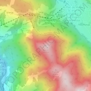
Name: Karspitze topographic map, elevation, terrain.
Average elevation: 1,469 m
Minimum elevation: 1,087 m
Maximum elevation: 1,900 m
Other topographic maps
Click on a map to view its topography, its elevation and its terrain.
Peitlerkofel
Italien > Trentino-Südtirol > Bozen > St. Martin in Thurn
Peitlerkofel, St. Martin in Thurn, Pustertal, Bozen, Trentino-Südtirol, 39030, Italien
Average elevation: 2,189 m
Restalt
Italien > Trentino-Südtirol > Bozen > St. Martin in Thurn > St. Martin in Thurn
Restalt, St. Martin in Thurn, Pustertal, Bozen, Trentino-Südtirol, 39030, Italien
Average elevation: 1,400 m