

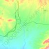
Baft topographic map
Click on the map to display elevation.
Baft
Baft (Persian: بافت) is a city in the Central District of Baft County, Kerman province, Iran, serving as capital of both the county and the district. It is 155 kilometres (96 mi) southwest of Kerman. Baft has an elevation of about 2,280 metres (7,480 ft).
About this map

Name: Baft topographic map, elevation, terrain.
Location: Baft, بخش مرکزی, Baft County, Kerman Province, Iran (29.20896 56.56311 29.25188 56.62765)
Average elevation: 2,277 m
Minimum elevation: 2,207 m
Maximum elevation: 2,579 m
Other topographic maps
Click on a map to view its topography, its elevation and its terrain.

دریاچه سد گوغر
Iran > Kerman Province > Baft County > دهستان گوغر > امیرآباد
Average elevation: 2,645 m