
尖石鄉 topographic map
Interactive map
Click on the map to display elevation.
About this map
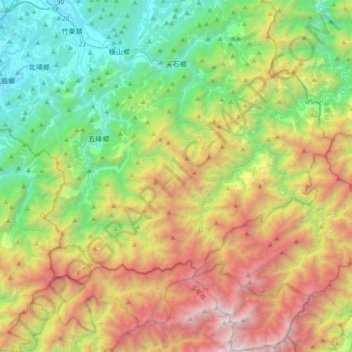
Name: 尖石鄉 topographic map, elevation, terrain.
Location: 尖石鄉, Comté de Hsinchu, Province de Taïwan, Taïwan (24.42737 121.15185 24.76529 121.41233)
Average elevation: 1,320 m
Minimum elevation: 72 m
Maximum elevation: 3,469 m