
Casas de Monforte topographic map
Interactive map
Click on the map to display elevation.
About this map
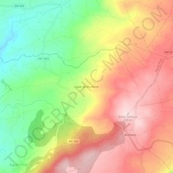
Name: Casas de Monforte topographic map, elevation, terrain.
Location: Casas de Monforte, Águas Frias, Chaves, Vila Real, Portugal (41.76722 -7.35058 41.80722 -7.31058)
Average elevation: 768 m
Minimum elevation: 585 m
Maximum elevation: 932 m
Other topographic maps
Click on a map to view its topography, its elevation and its terrain.
Avelelas
Portugal > Vila Real > Chaves > Águas Frias
Avelelas, Águas Frias, Chaves, Vila Real, 5400-603, Portugal
Average elevation: 767 m