
Plateaux Department topographic map
Interactive map
Click on the map to display elevation.
About this map
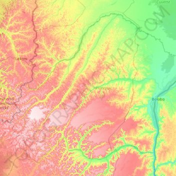
Name: Plateaux Department topographic map, elevation, terrain.
Location: Plateaux Department, Congo-Brazzaville (-3.08064 14.11111 -0.93700 16.67157)
Average elevation: 496 m
Minimum elevation: 272 m
Maximum elevation: 861 m
Other topographic maps
Click on a map to view its topography, its elevation and its terrain.
Soukissa
Congo-Brazzaville > Brazzaville
Soukissa, Brazzaville, Congo-Brazzaville
Average elevation: 302 m
Pako
Congo-Brazzaville > Sangha > Pako
Pako, Ouésso, Sangha, Congo-Brazzaville
Average elevation: 404 m
Cuvette-Ouest Department
Cuvette-Ouest Department, Congo-Brazzaville
Average elevation: 453 m