
Villeneuve topographic map
Interactive map
Click on the map to display elevation.
About this map
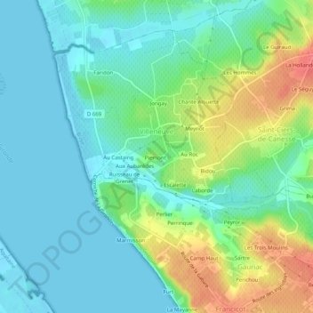
Name: Villeneuve topographic map, elevation, terrain.
Average elevation: 20 m
Minimum elevation: -1 m
Maximum elevation: 68 m
Other topographic maps
Click on a map to view its topography, its elevation and its terrain.
Berlot
Frankreich > Neu-Aquitanien > Gironde > Saint-Jean-d'Illac
Berlot, Saint-Jean-d'Illac, Bordeaux, Gironde, Neu-Aquitanien, Metropolitanes Frankreich, 33127, Frankreich
Average elevation: 43 m