
Ensley topographic map
Interactive map
Click on the map to display elevation.
About this map
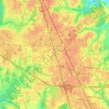
Name: Ensley topographic map, elevation, terrain.
Location: Ensley, Escambia County, Florida, United States (30.50335 -87.31346 30.55101 -87.22146)
Average elevation: 35 m
Minimum elevation: 6 m
Maximum elevation: 49 m
Other topographic maps
Click on a map to view its topography, its elevation and its terrain.
Ensley
United States > Florida > Escambia County > Ensley
Ensley, Escambia County, Florida, 32534, United States
Average elevation: 35 m