
Marron Valley topographic map
Click on the map to display elevation.
About this map
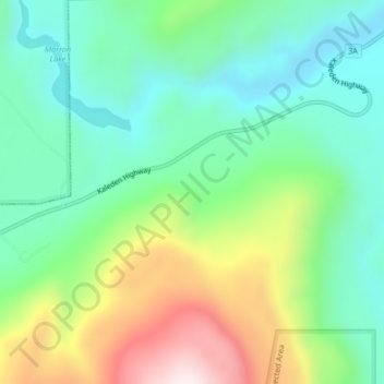
Name: Marron Valley topographic map, elevation, terrain.
Average elevation: 772 m
Minimum elevation: 554 m
Maximum elevation: 1,226 m
Other topographic maps
Click on a map to view its topography, its elevation and its terrain.
White Lake Grasslands Protected Area
Canada > British Columbia > Regional District of Okanagan-Similkameen > Area I (Skaha West/Kaleden/Apex)
Average elevation: 664 m
Brent Mountain Protected Area
Canada > British Columbia > Regional District of Okanagan-Similkameen > Area I (Skaha West/Kaleden/Apex)
Average elevation: 1,704 m
Skaha Lake
Canada > British Columbia > Regional District of Okanagan-Similkameen > Area I (Skaha West/Kaleden/Apex) > Kaleden
Average elevation: 701 m