Geolocate

Abaga topographic map

Click on the map to display elevation.

About this map

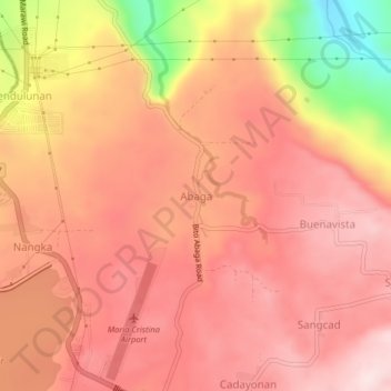
Name: Abaga topographic map, elevation, terrain.

Location: Abaga, Lanao del Norte, Northern Mindanao, Philippines (8.12334 124.20167 8.16334 124.24167)

Average elevation: 341 m

Minimum elevation: 93 m

Maximum elevation: 449 m

Gear up for your next adventure:

🌿Flora and Fauna Field Guides - Identify the plants and animals you encounter on your route
🧥Thermal Emergency Blankets - Compact Mylar blankets to prevent hypothermia if stranded overnight
🧊Insulated Stainless Steel Flasks - Keep water cold for 24 hours in the heat or coffee hot in the cold
🚗Car Camping Gear - Equipment for vehicle camping
📱Tablet Tripod Mounts - Steady platforms for viewing digital maps or taking long exposures

As an Amazon Associate, this site earns from qualifying purchases at no extra cost to you.