Geolocate

Manapati topographic map

Click on the map to display elevation.

About this map

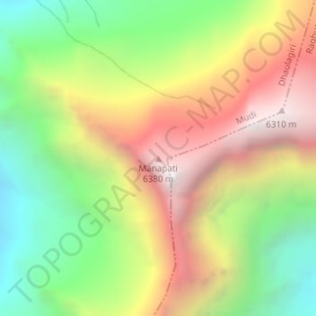
Name: Manapati topographic map, elevation, terrain.

Location: Manapati, Mudi, Dhaulagiri, Myagdi, Gandaki Pradesh, Nepal (28.64746 83.45516 28.64756 83.45526)

Average elevation: 5,382 m

Minimum elevation: 4,516 m

Maximum elevation: 6,373 m

Gear up for your next adventure:

🦟Insect Repellent - Protection against insects
📣High-Decibel Survival Whistles - Signaling tool for rescue that carries much further than a human voice
🕯️Emergency Whistles - Safety whistles for hiking
👕UPF 50+ Sun Shirts - Essential protection against the harsh Australian sun during field work
🩹Blister Prevention Tape - Apply to friction points before they become painful sores

As an Amazon Associate, this site earns from qualifying purchases at no extra cost to you.