
Thank you for supporting this site ❤️
Make a donation
Make a donation
Gear up for your next adventure:
As an Amazon Associate, this site earns from qualifying purchases at no extra cost to you.
Huddungeby topographic map
Click on the map to display elevation.
Thank you for supporting this site ❤️
Make a donation
Make a donation
Gear up for your next adventure:
As an Amazon Associate, this site earns from qualifying purchases at no extra cost to you.
About this map
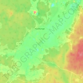
Name: Huddungeby topographic map, elevation, terrain.
Location: Huddungeby, Huddunge, Heby kommun, Uppsala County, Sweden (60.02236 16.96463 60.06236 17.00463)
Average elevation: 56 m
Minimum elevation: 20 m
Maximum elevation: 99 m
Thank you for supporting this site ❤️
Make a donation
Make a donation
Gear up for your next adventure:
As an Amazon Associate, this site earns from qualifying purchases at no extra cost to you.