
Canal du Moulin de la Blanche topographic map
Interactive map
Click on the map to display elevation.
About this map
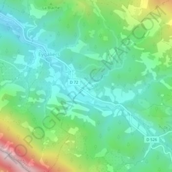
Name: Canal du Moulin de la Blanche topographic map, elevation, terrain.
Average elevation: 522 m
Minimum elevation: 355 m
Maximum elevation: 958 m
Other topographic maps
Click on a map to view its topography, its elevation and its terrain.
Aiguières
France > Auvergne-Rhône-Alpes > Drôme > Plaisians
Aiguières, D 526, Plaisians, Nyons, Drôme, Auvergne-Rhône-Alpes, France métropolitaine, 26170, France
Average elevation: 893 m
Les Arnauds
France > Auvergne-Rhône-Alpes > Drôme > Plaisians
Les Arnauds, Plaisians, Nyons, Drôme, Auvergne-Rhône-Alpes, France métropolitaine, 26170, France
Average elevation: 693 m