
Felinfoel topographic map
Interactive map
Click on the map to display elevation.
About this map
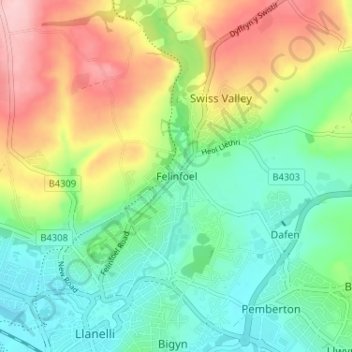
Name: Felinfoel topographic map, elevation, terrain.
Location: Felinfoel, Carmarthenshire, Wales, SA15 4LT, United Kingdom (51.67762 -4.16702 51.71762 -4.12702)
Average elevation: 66 m
Minimum elevation: 0 m
Maximum elevation: 178 m