
Thank you for supporting this site ❤️
Make a donation
Make a donation
Gear up for your next adventure:
As an Amazon Associate, this site earns from qualifying purchases at no extra cost to you.
Gikambura topographic map
Click on the map to display elevation.
Thank you for supporting this site ❤️
Make a donation
Make a donation
Gear up for your next adventure:
As an Amazon Associate, this site earns from qualifying purchases at no extra cost to you.
About this map
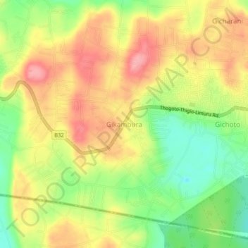
Name: Gikambura topographic map, elevation, terrain.
Location: Gikambura, Karai ward, Kikuyu, Kiambu, 00109, Kenya (-1.30330 36.61330 -1.26330 36.65330)
Average elevation: 2,014 m
Minimum elevation: 1,952 m
Maximum elevation: 2,070 m
Thank you for supporting this site ❤️
Make a donation
Make a donation
Gear up for your next adventure:
As an Amazon Associate, this site earns from qualifying purchases at no extra cost to you.