Geolocate

Springfield topographic map

Click on the map to display elevation.

About this map
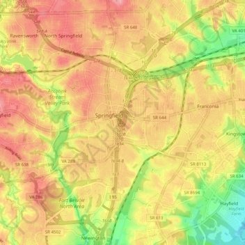
Name: Springfield topographic map, elevation, terrain.

Location: Springfield, Fairfax County, Virginia, 22150, United States (38.73804 -77.21878 38.81206 -77.15308)

Average elevation: 68 m

Minimum elevation: 6 m

Maximum elevation: 103 m

Gear up for your next adventure:

🎒3L Hydration Reservoirs - Hands-free drinking to stay hydrated on steep contour climbs
🛌Compact Down Sleeping Bags - Warmth without the bulk, ideal for backcountry camping
👟Lightweight Trail Runners - Agile footwear for fast movement over rugged Australian terrain
🧭Military Style Lensatic Compass - Durable sighting compasses for advanced land navigation and surveying
🆘Personal Locator Beacons (PLB) - Satellite emergency beacons for life-saving help in areas with no mobile coverage

As an Amazon Associate, this site earns from qualifying purchases at no extra cost to you.