
Scampton CP topographic map
Interactive map
Click on the map to display elevation.
About this map
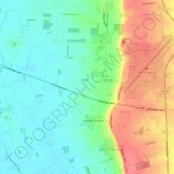
Name: Scampton CP topographic map, elevation, terrain.
Average elevation: 28 m
Minimum elevation: 3 m
Maximum elevation: 73 m
Other topographic maps
Click on a map to view its topography, its elevation and its terrain.
West Lindsey
United Kingdom > England > West Lindsey
West Lindsey, Lincolnshire, East Midlands, England, United Kingdom
Average elevation: 30 m
Somerby
United Kingdom > England > West Lindsey
Somerby, West Lindsey, Lincolnshire, East Midlands, England, DN21 3HH, United Kingdom
Average elevation: 22 m