
Wariyapola topographic map
Interactive map
Click on the map to display elevation.
About this map
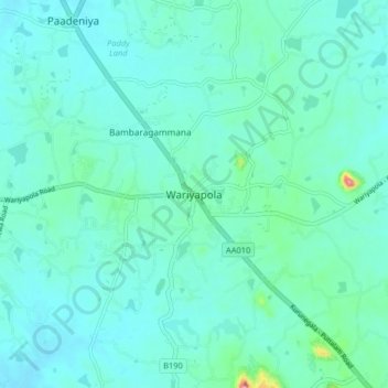
Name: Wariyapola topographic map, elevation, terrain.
Average elevation: 81 m
Minimum elevation: 31 m
Maximum elevation: 491 m
Other topographic maps
Click on a map to view its topography, its elevation and its terrain.
Eth Dath Wala Amuna
Sri Lanka > North Western Province > Wariyapola
Eth Dath Wala Amuna, Wariyapola, Kurunegala District, North Western Province, Sri Lanka
Average elevation: 86 m