
Borgomezzavalle topographic map
Interactive map
Click on the map to display elevation.
About this map
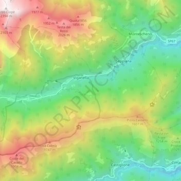
Name: Borgomezzavalle topographic map, elevation, terrain.
Location: Borgomezzavalle, Verbano-Cusio-Ossola, Piemont, 28846, Italien (46.02411 8.14291 46.07076 8.23689)
Average elevation: 1,082 m
Minimum elevation: 271 m
Maximum elevation: 2,364 m
Other topographic maps
Click on a map to view its topography, its elevation and its terrain.